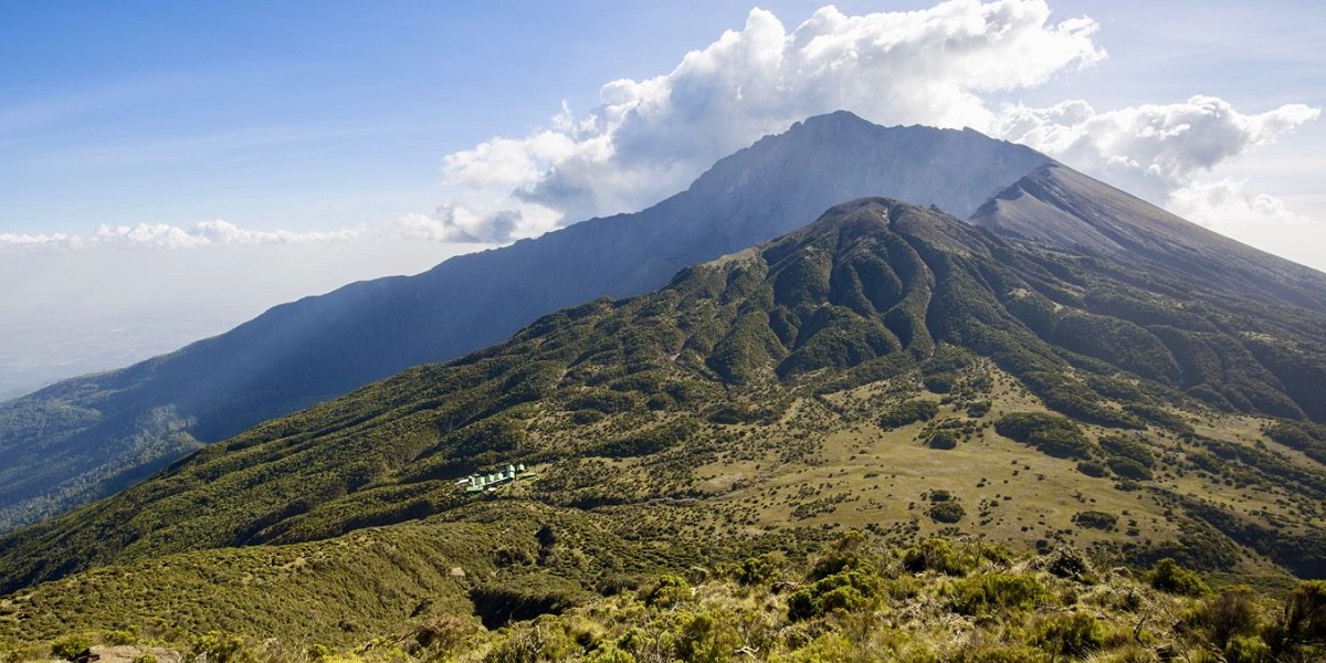
Mount Meru is part and parcel of Arusha National Park. It is the fifth highest mountain on the African continent and the second highest in Tanzania at 4566m. About 25,000 years ago, a massive volcanic blast blew away the entire eastern flank of the mountain and left it with the characteristic and distinctive appearance it has today. The dramatic crater of Mt Meru is often neglected in favor of its famous neighbor to the east, but a visit to this spectacular mountain, located within Arusha National Park, is cherished experience. Its lower slopes are covered in dense highland forest, where Colobus monkey play and buffalo gaze concealed beneath the thick foliage.
The extinct volcano’s extensive base gives way to a perfectly formed crater a subsidiary peak and the Momella Lakes and Ngurdoto Crater are visible from Meru slopes. Mount Meru is Tanzania’s second highest peak 4566m after Kilimanjaro. Climbing up and down on the same route with spectacular diversified view of Mt. Kilimanjaro and Ngorongoro highlands is fascinatin. Trekking Mount Meru takes a minimum of three days but a more comfortable and relaxed climb takes four days. During the trek, accommodation is in Huts which are shared by all trekkers.
Mount Meru is an active volcano standing at 4566 metre, and located about 70 kilometres west of Mount Kilimanjaro. Typically Mount Meru Climb takes four days, but it can be done in 3 days if time is limited. It is an excellent standalone trip or a prequel to climbing Kilimanjaro itself. Some people believe Mt. Meru is actually more challenging, and for sure it is much quieter.
The mountain is the centrepiece of Arusha National Park and its fertile slopes rise above the surrounding savanna and support a forest that hosts diverse wildlife, including nearly 400 species of birds, and also monkeys and leopards. Trekkers have the opportunity to see a lot of wildlife as they approach and climb the mountain.
The ascent is quite steep in places and the route to the summit passes over a number of streams, moving through grasslands, tropical rainforest, alpine meadows, moorlands and desert uplands to snow and ice. The summit is reached by a narrow, barren ridge, which provides stunning views of the Ash Cone lying several hundred feet below in the crater.