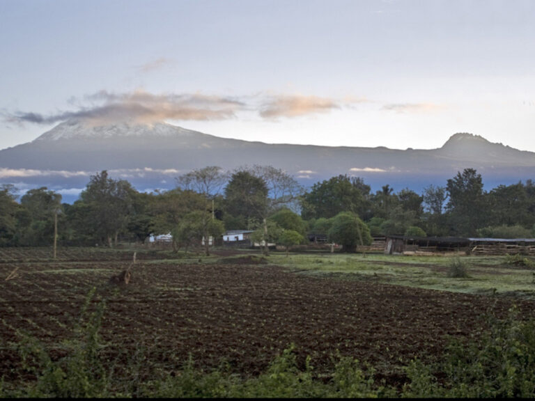
The name Kilimanjaro is a metaphor for the compelling beauty of Tanzania. When you see the mountain upclose, you will understand why. Not only is this the highest peak on the African continent; it is also the tallest free-standing mountain in the world, rising in breathtaking isolation from the surrounding coastal scrubland – elevation around 900 metres – to an imperious 5,895 metres (19,336 feet).
If you ask around, some people believe it means “Mountain of Light”, some will say it means “Mountain of Greatness” or “Mountain of Caravans”. Or it might not. The local people, the Wachagga, don’t even have a name for the whole mountain, choosing to call one peak only Kipoo (now known as Kibo) for the familiar snowy peak that stands imperious, overseer of the continent, the summit of Africa and the other “Kimawenzi” (Mawenzi).
Kilimanjaro is one of the world’s most accessible high summits, a beacon for visitors from around the world. Most climbers reach the crater rim with little more than a walking stick, proper clothing and determination. And those who reach Uhuru Point, the actual summit, or Gillman’s Point on the lip of the crater, will have earned their climbing certificates. And their memories.
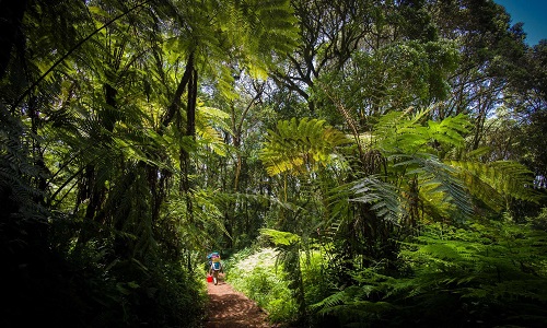
But there is so much more to Kili than her summit. The ascent of the slopes is a virtual climatic world tour, from the tropics to the Arctic. Even before you cross the national park boundary (at the 2,700m contour), the cultivated footslopes give way to lush mountain forest, inhabited by elusive elephant, leopard, buffalo, the endangered Abbot’s duiker, and other small antelope and primates. Higher still lies the moorland zone, where a cover of giant heather is studded with otherworldly giant lobelias. Above 4,000m, a surreal alpine desert supports little life other than a few hardy mosses and lichen. Then, finally, the last vestigial vegetation gives way to a winter wonderland of ice and snow – and the magnificent beauty of the roof of the continent.
Kilimanjaro has five common routes to its highest summit: Marangu Route; Machame Route; Rongai Route; Lemosho Route; and Mweka Route. Machame and Lemosho routes are more scenic but Marangu is the easiest and most popular.
Majestic Serengeti Safaris will take you up through your selected route but we usually advise our guests to select one of the two most popular routes because of easy availability of service and comfort: Marangu and Machame routes.
Phases of Climb
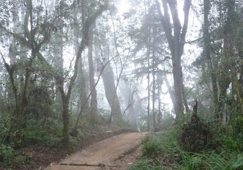
First Stage: Tropical Forest
A short distance from the the park gate (Marangu or Machame), at around 1,850m you come across the first experience of mountain environment. Recent encroachment by local farmers has meant that the old lowland forest is now cultivated and settled, so trekking begins with the dense vegetation of tropical forest between 1850m and around 2800m.
Cloud condensation mainly gathers around the forest, so this area is usually damp or drenched with rainfall, creating an intriguing mass of plant life and running streams.
Elevation: 6,000′ – 9,000′ Day Temps: 70’s-90’s F Night Temps: 40’s-60’s F
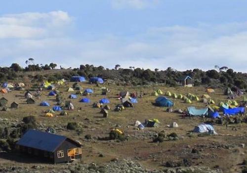
Open Moorland
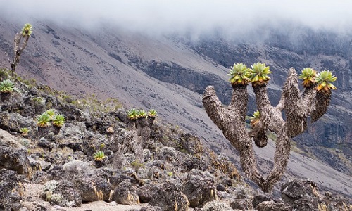
From around 3,200m a wide expanse of moorland extends beyond the heath and the cloud line, so that here the skies are generally clear, making the sunshine intense during the days and the nights cool and clear.
The climbing incline remains gentle, but thinning oxygen provides less fuel to energize the muscles and can dramatically slow the pace of walking. Hardy endemic species of Giant Groundsels (Senecio) and Lobelia (Deckenii) towering up to 4m high thrive in this zone.
Elevation: 11,000′ – 13,000′ Day Temps: 50’s-70’s F Night Temps: 30’s-50’s F
Alpine Desert, Sparse Vegetation
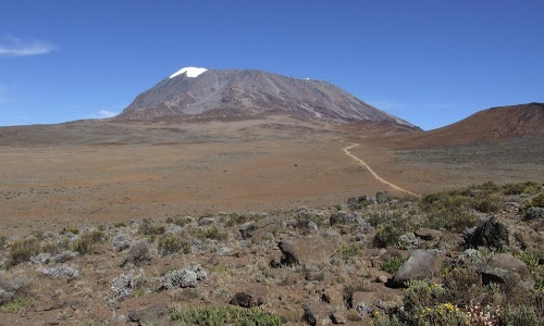
Even higher, beyond 4,000m, this sensation intensifies as the landscape develops into a more bizarre alpine desert, with sandy loose earth and intense weather conditions and temperature fluctuations so dramatic that barely any plant species survive.
Only the odd lichen survives beyond 5000m, after Kibo Huts and beyond the Saddle, where the landscape is predominantly rock and ice fields. Here, climbers experience the final steep push to the summit.
Elevation: 13,000′ – 16,000′ Day Temps: 30’s-40’s F Night Temps: 10’s-30’s F

Saddle to Summit
The easterly routes, Marangu, Mweka, Loitokitok and Rongai all converge west of the saddle near Gillmans Point, between the peaks of Mawenzi and Kibo. Kibo’s crater is roughly circular with an inner cone extending to 5,800m, (100m lower than Uhuru Peak).
The crater at the centre with walls between 12 and 20 m high contains another minor cone, the centre of which falls into the 360m span of the ash pit. This is the 120 metre deep central core of the volcano, and casts sulphurous boiling smoke from its depths.
Elevation: 16,000’+ Day Temps: 10’s-30’s F Night Temps: 10’s-20’s F
The Marangu Route has been referred to as the ‘Coca Cola’ route and this has led potential climbers to think that it is an easy route to the summit. This is far from the truth! The fact that it requires a minimum of 5 days to complete does not mean that it is easier than any other route. The only reason that people say it is easier is because it is the only route up where you sleep in huts as opposed to tents.
An optional acclimatization day at Horombo Huts is highly recommended for those with no prior trekking in altitude experience under their belt.
Click here to see some packages offered using Marangu route.
Machame Route is highly rated as the most scenic route of all those up Kilimanjaro, with diverse vegetation and wide views as well as a number of possible route choices beyond the Lava Tower Camp at 4630m.
Machame Route can take either six, seven or eight days to complete, depending on your fitness, and available time. This route sets off from Machame village, and reaches the first Machame Camp at 3000m where the forest meets the heather. The track continues across moorland to Shira Camp on the western side of Kibo, with excellent views over the Shira Plateau.
Click here to see available packages using Machame route.